Tides, winds and tempered hopes.
Breaking the code of breaks — a decade-long quest from Maine to Rhode Island.
Miki Dora, surfing’s first modern archetype and antihero, once described waves as “the ultimate illusion” because they “come out of nowhere, instantaneously materialize, and, just as quickly, break and vanish.” (1)
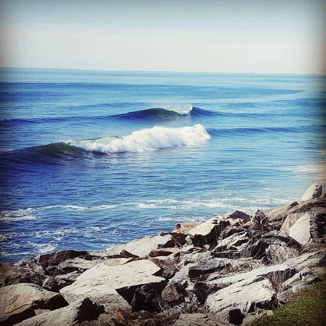
If any coastline bears witness to the fleeting nature of ocean waves, it’s New England. Here, environmental factors that enhance the size, shape, and power of waves — prevailing winds, the continental shelf and ocean fetch — tend to work against them.
On the West Coast, the prevailing winds of the Pacific Ocean are inward, meaning they are behind the waves and increase their energy. In the Atlantic, prevailing winds are outward, blowing against ocean waves and decreasing their energy. The West Coast’s narrow continental shelf, the area of the shore where discernible drop-off occurs, helps magnify the size of breaking waves, while the East Coast’s broader shelf creates friction that blunts waves. And, because the Pacific is more expansive than the Atlantic, its waves travel farther and have more time to increase in size and duration than their eastern counterparts. (2)
In New England, the phantasm of the perfect wave is further fettered by raw, jagged coastlines that jut out in so many directions the cardinal, half cardinal and false compass points frequently factor into swell and wind measurements. Toss in tempestuous tide swings, impetuous winds that bend with abandon — not to mention biting cold air and water temps — and you have a rash, temperamental environment that forcers surfers to make the inhospitable hospitable. More often than not, that means schlepping long distances in inclement weather for what amounts to a few minutes of euphoria; and sporting thick, head-to-toe neoprene to forestall hypothermia.
It’s no surprise then to find empty lineups at many fickle breaks from Bar Harbor to Westerly. And, while there are a growing number of hardened rippers who routinely shred the region’s rocky points and wedgy sandbars, it’s still more common, even at spots that draw crowds, to see more tight turns and smooth arcs than layback snaps and aerial prowess.
Getting a read on the coast
I have spent the better part of a decade gaining an increasingly deep understanding of the New England coastline. It’s one that doesn’t lend itself to run-of-the-mill analysis.
On any given day when the North Atlantic is pulsing, swell and wind direction plus tidal flow may only line up for a short period of time. Learning when it’s “go time” and, thus, when to strike is paramount for any New England surfer.
Tempestuous tides
Tide stage is the most difficult of the three components to estimate without first-hand knowledge and lots of recorded data. For this reason, many breaks, especially the more remote ones, remain a black box for the vast majority of swell seekers.
I've done my fair share of homework on tide mechanics over the years. For those hungry to dive deeper into the complex world of oceanic rhythms, coastal interactions and geophysical forces, scroll down to the dedicated section below, where I unpack the intricacies of this maritime movement.
Shifting swells
Knowing what swell directions will light up a given area means knowing its geography.
Throughout New England, the coasts take on many sizes and shapes, from New Hampshire’s quaint 13-mile stretch to the sprawling, dune-flanked shores of the upper Cape. Variety really comes into the picture at the region’s northern and southern ends.
Maine's coastline performs a rugged and dramatic dance of granite and ocean, with many a nooks amongst its twists and turns. Rhode Island, though diminutive, weaves its own intricate labyrinth that demands miles of beach combing to master its craggy, cove-laden shores.
Just as New England's coastline defies simple description, its swell patterns pulse with equal complexity. Within a single four-hour stretch, overlapping ESE and SSE swells can emerge and reshape waves forming as they roll over rock reefs and sand bars.
As Dave Levy, Rhode Island native and founder of LSD Surf Designs, explains, “there’s always wind working in the right direction somewhere”. That’s an apt summation for New England. (3)
Wayward winds
The reality of winds across the region defies digital prediction. Promising forecasts of the winds’ knots and direction can dissolve the moment you reach the shore, with local topography and microclimates generating patterns that render digital models mere suggestions.
Similarly, ocean buoy readings, those more distant maritime sentinels, often tell an incomplete story — wind conditions a few miles offshore can bear little resemblance to what’s unfolding along the coastline, where rocky shores, inland terrain and sudden atmospheric shifts conspire to create their own mercurial narrative.
On tides
As noted above, tide stage tends to be the hardest of the three “go time” components to estimate, as it relies on first-hand observation and water-level measurements that vary over time with the rise and fall of sea levels triggered by the combined gravitational effects of earth’s orbit around the sun and the moon’s orbit around earth.
Harry Knight, an experienced mariner and coach at the Surf Simply resort and school in Nosara, Costa Rica, has given an informative talk on measuring tide using the “rule of twelfths,” an approximation to a sine curve. This approach, to which he devoted a portion of a podcast, can be used to estimate the ideal amount of water — stemming from a specific tide stage — a break needs to produce quality waves. The approach, and the astronomical phenomena behind tide fluctuations and the nautical methods for gauging them, are summarized below. (4)
How tides work
As the earth rotates in 24-hour cycles, the 71 percent of its surface that is water gets pulled around by the aforementioned gravitational forces, creating tides. In many regions, New England included, the tides are “semi-diurnal,” meaning there are two nearly equal high and low tides in a day, each separated by approximately 6 hours.
The positions of the sun and the moon relative to each other and to earth dictate the extent to which the tide moves up and down. When earth, the sun, and the moon line up, there are full or “new” moons, and the range between high and low tide is wide — this is called a “spring” tide. When the sun and the moon are at 90 degrees to earth, a half moon appears, resulting in “neat” tides — in which the high-to-low range is narrow. Since the moon orbits earth once a month, the cycles from spring to neat tides tend to be about four weeks.
Earth’s elliptical orbit around the sun, plus its distance from the star, also impacts tide ranges. As earth spins, the movements of water are pulled into rotation around “amphidromic points” or “tidal nodes” in the ocean. The further away a break is from the points, the bigger its H-to-L tide range. The nearest point to New England is off Newfoundland, 780 miles from Bar Harbor.
How the “rule of twelfths” applies to tides
Simply put, different breaks work best at different stages of the tide. However, the tide’s three stages — high, mid, low — alone are imprecise gauges for surf forecasting. Surfers, Knight argues, should think of tide in terms of absolute heights versus three relative values that can change astronomically as a result of astronomical occurrences.
In most countries, tide heights are measured using “chart datum” — the level of water from which charted depths displayed on a nautical chart are measured. It is typically derived from a stage of the tide, and its values can be used to show how much water will be over a break at H or L tide, or how far up or down a beach water will travel each day. The United States’ National Oceanic and Atmospheric Administration (NOAA) uses “mean lower low water (MLLW)” — the average height of the lowest tide recorded at a tide station each day during a 19-year period. This is why it’s common to see negative low-tide readings in the U.S.
Though the speed of their movements can vary from low to high stages, tides flow according to predictable patterns. Applying the “rule of twelfths” to tide flow at specific breaks and at specific times can help surfers estimate the amount of water present during a sesh. Once favorable and unfavorable conditions are observed and session start- and end-times are logged, the rule can be used to calculate the tidal height and use the measurement to plan future surfs.
High tide height – Low tide height = Tide range
Tide range ÷ 12 = Size of each twelfth
Size of each twelfth x Number of twelfths since the last high or low tide = Tide change
Height of last high/low tide -/+ Tide change = Current tide height
The formula works by calculating the difference in height between H and L tide, the “tide range.” The difference is divided by 12 to determine the size of each twelfth. That figure is then multiplied by the number of twelfths since the last H or L tide to calculate the “tide change.” (5) The current tide height is derived by subtracting or adding the height of the last H or L tide from/to the tide change. This nets the current tide height.
Example: 2-hour sesh after H tide, with 9.5 ft H and 1.3 ft L
9.5ft – 1.3ft = 8.2 ft tide range
8.2ft ÷ 12 = 0.683ft size/twelfth
After 2 hours, it is expected 3 twelfths would have gone out
0.683ft x 3 = 2.1ft tide change
9.5ft – 2.1 = 7.4ft current tide height
According to the formula, at L tide, 1/12th of the tide range surfaces during the 1st hour, followed by 2/12ths during the 2nd and 3/12ths during the 3rd and 4th. As H tide approaches, the tide flow slows down, resulting in 2/12ths in the 5th hour and 1/12th in the 6th and final hour. The tide goes out via the same pattern. This formula helps attach numerical values to the fact that, at H and L tides, the ocean moves slowly, while at mid tide, it moves quickly — e.g., during the 2 hours at either end of H or L tide, only 1/12th of the total comes in and goes out again — a movement that’s largely imperceptible. But, during the middle 2 hours, half of the total, or 6/12ths, flows in or out.
Planet Calc has created a “rule of twelfths” calculator that can be used to log tide flows.
Footnotes
Lawler, Kristin. “The American Surfer: Radical Culture and Capitalism.” Routledge, 2011.
Ellis, Richard. “Encyclopedia of the Sea.” Knopf, 2000.
Carberry, Joe. “Winter’s Respite.” SUP Magazine, date unknown.
Knight, Harry. “16 Tides And The Rule of Twelfths.” SurfSimply.com, July 8, 2015.
A six-hour gap between H and L tides is considered the norm, and the tide is expected to move by a fixed amount.


